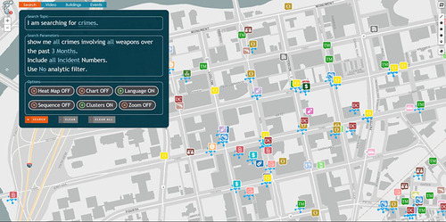
SEARCH
Directly connect to your disparate data sources and apply rules for easy searching.
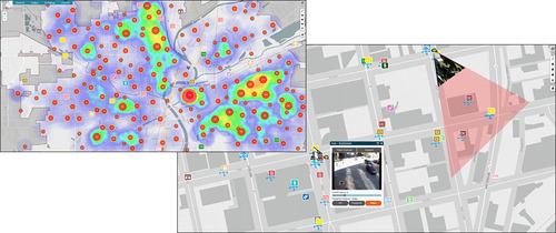
GEO-ANALYTICS
Your data on a map and analyzed in real-time.
INTEGRATION
Cameras and sensors are just the beginning.
Directly connect to your disparate data sources and apply rules for easy searching.
Your data on a map and analyzed in real-time.
Cameras and sensors are just the beginning.
Whether fusing hundreds of sensors, data points, cameras, heat maps, license plate readers, chem/bio sensors, or other sensor inputs, it's all searchable and projected in real-time to the GPS-accurate map. Query one or multiple datasets, it's up to you.

Immediately analyze large collections of incidents to identify problem locations. Adjust the time frame to see how hot spots change over time.
With OSUS integration, your existing infrastructure of sensors and cameras can be controlled and viewed directly on the map. Overlap this with your geographic data for additional insight.
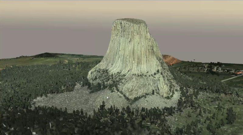
Need detailed maps? If we don't already have them integrated, our partner can make them for you. This comes in two flavors, high-resolution 3D from 12,000 feet and aerial imagery with details down to 2 centimeters! Contact us for the latest in mapping technology.